Table of Contents >> Show >> Hide
- Why the Air Force Is Looking Beyond GPS
- How Magnetic Navigation Actually Works
- Why This Is Harder Than It Sounds
- The Air Force Milestones That Made This Story Real
- What Makes Magnetic Navigation Attractive
- What the Technology Still Cannot Magically Fix
- Will Magnetic Navigation Replace GPS?
- Why This Matters Beyond the Military
- Operational Experience and What This Could Feel Like in the Real World
- Conclusion
- SEO Tags
If that headline sounds like something cooked up by a sci-fi screenwriter who had too much coffee and access to a physics textbook, fair enough. But the underlying story is real. The U.S. Air Force has been testing magnetic navigation systems that use subtle variations in Earth’s magnetic field to help aircraft figure out where they are when GPS is unavailable, jammed, spoofed, or simply not trustworthy. In other words, when satellites become unreliable, the military wants airplanes to stop looking up for directions and start “reading” the planet below.
That does not mean every fighter pilot is suddenly flying by cosmic vibes and geomagnetic intuition. It means the Air Force, together with partners in government, academia, and industry, is investing in a serious backup navigation method for a world where GPS-denied operations are no longer hypothetical. That matters because modern airpower depends on precise positioning, navigation, and timing. If an adversary disrupts that flow, even the most advanced aircraft can start having a very bad day.
So what is actually happening here? How can Earth’s magnetic field help guide a jet? Why is artificial intelligence involved? And is this a true replacement for GPS, or more like a very smart backup singer waiting for the lead vocalist to lose power?
Why the Air Force Is Looking Beyond GPS
GPS transformed aviation. It made navigation more precise, more global, and much easier to integrate into everything from civilian airliners to bombers, cargo planes, drones, and missiles. The problem is that GPS is also vulnerable. Signals from satellites are weak by the time they reach Earth, which makes them susceptible to jamming and spoofing. In a major conflict, those signals could also be degraded by cyberattacks, anti-satellite operations, or a broader electronic warfare campaign.
That is why the Pentagon has been pushing the broader idea of assured positioning, navigation, and timing, often shortened to PNT. The goal is not to throw GPS in the trash like an old road atlas. The goal is to build resilient navigation systems that keep working when GPS does not. Magnetic navigation fits neatly into that strategy because it is passive, always available, and much harder to jam in the traditional sense.
Think of GPS as a helpful friend texting you directions from orbit. Magnetic navigation is more like learning the shape of the neighborhood itself. One can be blocked. The other is built into the planet.
How Magnetic Navigation Actually Works
Earth’s magnetic field is not perfectly uniform. It varies from place to place because of the planet’s core, crust, mineral composition, and other geological features. These variations create what researchers often call magnetic anomalies. If those anomalies are mapped in enough detail, an aircraft can compare what its onboard magnetometers are sensing in real time against a reference map and estimate its location.
That process is often described as map matching. The aircraft measures the magnetic environment around it, then asks a very sophisticated question: “Where on Earth does this magnetic fingerprint make the most sense?” If the answer is good enough, the system can update the aircraft’s position without asking GPS for help.
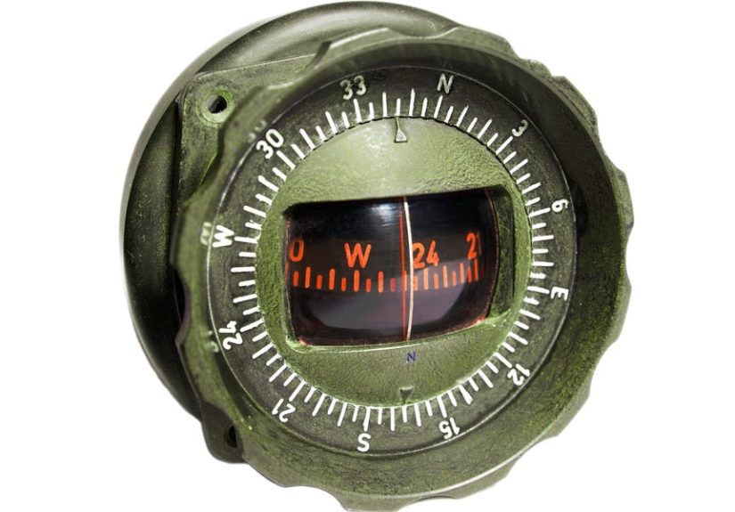
There is also an important distinction here. Magnetic navigation is not just a fancier compass. A compass gives direction relative to magnetic north. Magnetic anomaly navigation uses a richer dataset, including local changes in magnetic intensity and structure, to help determine position. It is closer to recognizing a landscape than simply knowing which way north is.
This is where the World Magnetic Model and related geomagnetic mapping tools come into the picture. They help establish a broad understanding of Earth’s magnetic environment, while more detailed anomaly maps can support higher-precision regional navigation. The science is real, the maps are real, and aviation has relied on magnetic-field references for years in heading systems. What is new is the Air Force’s effort to push those ideas into far more advanced, real-time navigation roles.
Why This Is Harder Than It Sounds
If Earth is already wrapped in a giant magnetic field, why not just slap a magnetometer on every airplane and call it a day? Because airplanes are noisy. Electrically noisy. Magnetically noisy. “Helpful backup navigation device” noisy in the same way a rock concert is “a great place for quiet reflection.”
Modern aircraft are packed with electronics, wiring, engines, lighting systems, avionics, structural components, and mission equipment that generate their own magnetic interference. All of that can contaminate the sensor data. A magnetometer mounted on an aircraft does not just see Earth’s signal. It also sees the aircraft’s signal, and separating the two in real time is difficult.
That is one reason magnetic navigation looked promising for years without becoming practical at scale. The concept worked in theory, but real aircraft are messy. Researchers needed better ways to filter out onboard noise, compensate for changing flight conditions, and make the whole system fast enough for operational use.
That is where machine learning and modern computing stepped in. Instead of trying to solve every interference problem with old-school calibration alone, Air Force and MIT-affiliated teams began using AI and neural-network-based approaches to identify patterns, subtract aircraft-generated noise, and isolate the magnetic data that actually matter for navigation.
In plain English: the airplane is shouting, Earth is whispering, and AI is helping the system hear the whisper.
The Air Force Milestones That Made This Story Real
Early Research Proved the Concept
Long before flashy headlines started bouncing around the internet, researchers at the Air Force Institute of Technology were already demonstrating that airborne magnetic anomaly navigation could work. A 2016 AFIT dissertation reported navigation accuracy of about 13 meters under favorable conditions using real flight data, high-quality maps, and low-altitude operations. That was not the final operational answer, but it was a serious proof of concept. It showed magnetic navigation was more than an academic curiosity.
In other words, the idea had graduated from “interesting physics project” to “this may actually help aircraft navigate.”
The 2023 C-17 Demonstration Was a Major Breakthrough
The bigger milestone came in 2023, when the Department of the Air Force-MIT AI Accelerator’s MagNav project performed real-time magnetic navigation aboard a C-17A Globemaster III. According to the Air Force, this was the first real-time demonstration of the technology on a Department of Defense aircraft. The test involved multiple C-17 sorties and drew support from MIT, MIT Lincoln Laboratory, the Air Force Research Laboratory, and the Air Force Institute of Technology.
That mattered for two reasons. First, it proved the technology could work on a real military aircraft rather than just in a lab or tightly controlled research environment. Second, it showed AI models could be trained and adapted quickly enough to make real-time magnetic navigation viable in flight.
For military aviation, that was not a science fair ribbon. That was a meaningful step toward a GPS-resilient future.
The 2024 Flights Pushed the Concept Further
In 2024, reporting from AP, Aviation Today, Air & Space Forces Magazine, and SandboxAQ added a new layer to the story. A C-17 flight tied to SandboxAQ’s AQNav system reportedly used AI-enabled magnetic navigation as a primary alternative PNT method during a real-world demonstration. The company and coverage around the event described it as a milestone in using Earth’s magnetic signatures, quantum magnetometers, and onboard AI to navigate without GPS.
This is an important nuance: the Air Force is not replacing GPS fleetwide tomorrow morning. But the service is moving from “can this work at all?” to “can this work as a meaningful operational backup?” That is a huge shift.
The Broader Air Force Trend Continued in 2025
By 2025, the Air Force was still publicly discussing alternative navigation in contested environments, including flight tests of third-party navigation software on unmanned aircraft. Not all of that testing was magnetic navigation specifically, but it reinforced the broader trend. The Air Force clearly sees internal, GPS-independent navigation as a priority, especially for operations where jamming and spoofing are expected rather than merely feared.
Magnetic navigation is part of that wider hunt for resilient navigation. It is one arrow in a growing quiver, not the only arrow.
What Makes Magnetic Navigation Attractive
The big selling point is resilience. Magnetic navigation is passive, meaning it does not need to broadcast signals. That makes it harder for an adversary to detect, target, jam, or spoof in the same ways they might disrupt satellite navigation. The magnetic field also does not disappear when satellites are attacked or communications are degraded.
It is also all-weather and day-night friendly. Terrain-based optical navigation can struggle in certain visual conditions. Radio systems can be interfered with. Inertial systems drift over time. Magnetic navigation offers a different kind of reference signal, which makes it especially valuable when fused with other sensors rather than used alone.
That fusion is a key point. The smartest path forward is probably not GPS versus magnetic navigation. It is GPS plus inertial navigation plus magnetic navigation plus other alternatives, all working together so one failure does not collapse the whole system. Military planners love redundancy, and for good reason. One navigation source is convenience. Several independent sources are survivability.
What the Technology Still Cannot Magically Fix
For all its promise, magnetic navigation has limits. Accuracy depends heavily on map quality, location, altitude, signal-processing quality, and the strength of local magnetic gradients. Some regions give richer magnetic fingerprints than others. Higher altitudes can reduce the strength of surface-related anomaly cues. Aircraft noise remains a major engineering challenge. Integration into operational fleets must also account for size, weight, power, cost, maintenance, and certification demands.
There is also a practical truth that rarely makes the splashiest headlines: backup navigation does not need to be perfect to be useful. It just needs to keep an aircraft oriented, survivable, and mission-capable when GPS is compromised. For some missions, a resilient fallback that gets you within the right corridor may be enormously valuable, even if it does not match ideal GPS precision at all times.
So no, this is not wizardry. It is engineering tradeoffs. Very smart engineering tradeoffs.
Will Magnetic Navigation Replace GPS?
Probably not in the near term, and not in the simple, cinematic way headlines sometimes imply. GPS remains globally scalable, deeply integrated, and extraordinarily useful. The military is still modernizing GPS itself through stronger, more secure capabilities. Magnetic navigation is better understood as a complement and contingency layer rather than a one-for-one replacement.
That said, there are environments where magnetic navigation could become more than a backup. Cargo aircraft, drones, special mission platforms, and autonomous systems operating in GPS-hostile conditions may benefit greatly from a mature magnetic navigation solution. Over time, as sensors improve and AI models get better at filtering interference, the role of MagNav could expand.
And that is the real point. The Air Force is not betting on a single silver bullet. It is building a more resilient navigation ecosystem. Magnetic navigation stands out because it turns an ancient planetary feature into a modern military advantage. That is not just clever. It is strategically elegant.
Why This Matters Beyond the Military
Military research often spills into commercial and civilian aviation over time, especially when it concerns safety, resilience, and autonomy. If magnetic navigation continues to mature, it could eventually influence how aircraft, drones, and other vehicles navigate in disrupted environments. The same underlying logic applies whether the threat is warfare, signal interference, system failure, or operating in areas where external navigation support is weak.
That does not mean your next vacation flight will navigate by Earth’s crust next year. But it does mean the future of navigation may be more layered, more sensor-rich, and less dependent on any single source than the recent past.
Operational Experience and What This Could Feel Like in the Real World
One of the most interesting parts of this story is not just the technology, but the experience it could create for crews and mission planners. In a GPS-friendly world, navigation can feel almost invisible. The system works, the route populates, the displays update, and the aircraft moves along as though the sky itself were neatly labeled. In a contested environment, that comfort evaporates fast. Suddenly, navigation is not background software. It becomes a live tactical problem.
Imagine a mobility crew flying into a theater where electronic warfare is expected. Nobody needs to be dramatic about it. The challenge is practical enough already. If GPS signals become unreliable, the crew must still know where they are, where they are going, how to maintain separation, and how to execute the mission without wandering into danger or simply wasting time and fuel. That is where a magnetic-navigation-backed system becomes more than a research novelty. It becomes stress reduction with a technical backbone.
From the pilot’s perspective, the ideal experience is not flashy. It is boring in the best possible way. The display still offers trustworthy guidance. The aircraft still has a reliable sense of position. The crew still has options. In aviation, boring often means successful. No pilot is asking for an inspirational geomagnetic adventure. They want dependable information and enough confidence to keep moving.
There is also a planning experience behind all this. Commanders and operators are increasingly forced to assume GPS degradation is not a rare edge case but a normal feature of future conflict. That changes training, mission design, route selection, and technology priorities. Systems like MagNav give planners another layer to work with. Instead of hoping GPS stays clean, they can begin designing missions around resilience from the start.
For maintainers and engineers, the experience is different again. Their challenge is making these systems portable, calibratable, repeatable, and practical across fleets. A technology that works only on one research aircraft under perfect conditions is interesting. A technology that can be moved, adapted, and scaled is useful. That is why so much attention has gone into generalizing the models, improving onboard processing, and shrinking the hardware burden.
There is a quiet human factor here too. Trust matters. Aircrews must trust that the backup system is credible before they will rely on it in high-stakes situations. That trust is built through repeated flights, test events, comparative performance, and clear understanding of the system’s limits. In that sense, magnetic navigation is not just a sensing problem. It is also a confidence-building problem.
And for anyone who loves aviation technology, there is something undeniably fascinating about the broader experience of this shift. After decades of navigation becoming more satellite-centered, engineers are rediscovering the value of Earth itself as a guide. The planet is no longer just the thing under the airplane. It is part of the navigation architecture. That is a remarkable full-circle moment: cutting-edge aircraft, AI models, and quantum sensors teaming up to read a signal nature has been broadcasting the whole time.
So yes, there is technical complexity here. There is strategy, geopolitics, and lots of unglamorous calibration work. But there is also something refreshingly grounded about it. When the Air Force experiments with magnetic navigation, it is not escaping the laws of physics. It is leaning into them. And in a world where the most advanced systems can still be jammed, spoofed, or denied, there is real comfort in a backup plan written into the Earth itself.
Conclusion
The Air Force’s push into magnetic navigation is not hype, but it is not magic either. It is a real, measured response to a real military problem: what happens when GPS cannot be trusted. Through research at AFIT, demonstrations on a C-17, AI-enabled signal filtering, and continued testing inside the broader push for alternative navigation, the service is showing that Earth’s magnetic field can play a serious role in future aviation resilience.
The smartest takeaway is also the simplest one. Magnetic navigation is not here to make GPS obsolete overnight. It is here to make aircraft harder to blind, harder to confuse, and harder to stop. And in modern warfare, that is more than a clever trick. That is a strategic advantage hiding in plain sight or more accurately, hiding in the planet under your wings.